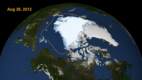
This image — called a “visualization” — shows the extent of Arctic sea ice on August 26, 2012, the day the sea ice dipped to the smallest extent ever recorded in more than three decades of satellite measurements. (NASA Goddard Space Flight Center photo)
Every summer the Arctic ice cap melts down to what scientists call its “minimum” before colder weather builds the ice cover back up. The size of this minimum remains in a long-term decline. The extent on August 26, 2012 broke the previous record set on September 18, 2007. The line on the image shows the average minimum extent from the period covering 1979-2010, as measured by satellites. According to scientists from NASA and the National Snow and Ice Data Center, the 2012 melt season could still continue for several weeks.
For more information on this image, and links to additional information on arctic sea ice, visit the NASA website.


